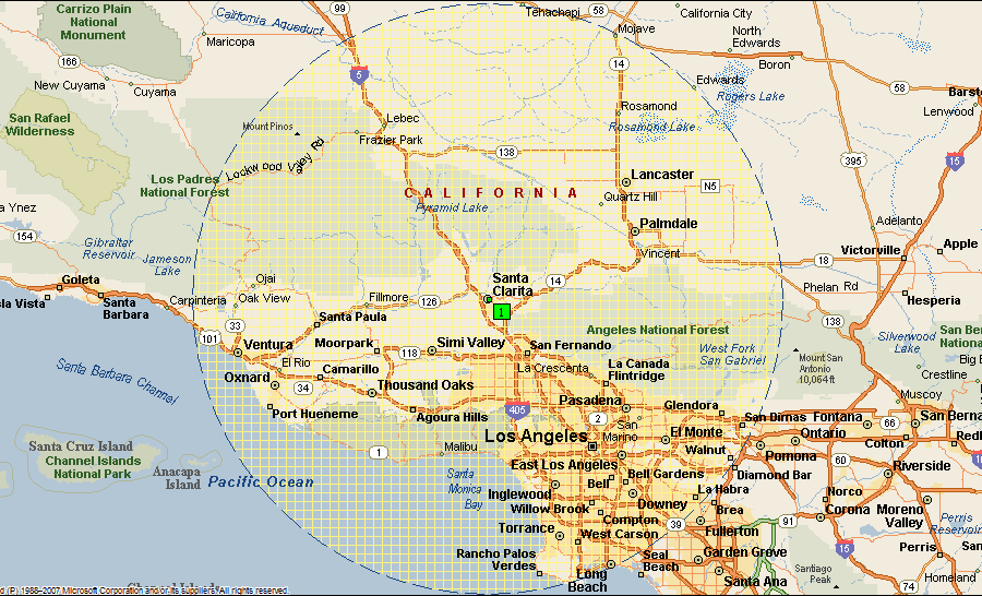
officially the City of Santa Clarita, is the third largest city in Los Angeles County, California,and the 24th largest in the state of California. The city has annexed a number of unincorporated areas, contributing to the large population increase. It is located about 35 miles (56 km) northwest of downtown Los Angeles, and occupies most of the Santa Clarita Valley. It is a notable example of a U.S. edge city or boomburb. Santa Clarita was ranked by Money magazine in 2006 as 18th of the top 100 places to live.
Santa Clarita was incorporated in December 1987 as the union of four unincorporated communities, Canyon Country, Newhall, Saugus, and Valencia, most of which are situated on the land of the former Rancho San Francisco.The four communities retain separate identities, and it is common for residents to refer to a specific neighborhood when asked where they are from. Santa Clarita is bounded on the west by the Golden State Freeway (I-5). The Antelope Valley Freeway (SR-14) runs northeast-southwest through an irregular east border, and the Newhall Pass is the city’s southernmost point.
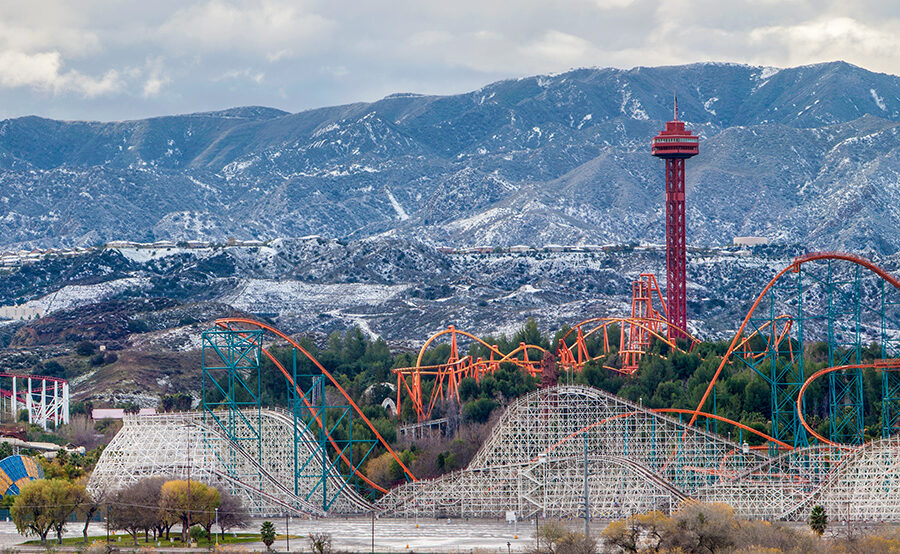
Six Flags Magic Mountain amusement park and Stevenson Ranch are both commonly associated with Santa Clarita, but are located just outside the city limits.
Geography
Santa Clarita, according to the United States Census Bureau, has an area of 62.16 square miles (161.0 km2), of which 62.10 square miles (160.8 km2) is land and 0.06 square miles (0.16 km2) (0.099%) is water.
Santa Clarita is near the San Fernando fault zone and was affected by the 1971 San Fernando earthquake, also known as the Sylmar quake. The city was also affected by the 1994 Northridge earthquake, and many commercial and residential buildings were devastated by its aftermath, including the nearby Newhall Pass, the Valencia Town Center, and Six Flags Magic Mountain. Magic Mountain’s 38-story Sky Tower swayed six feet in each direction during the Northridge earthquake with only minor damage.
Santa Clarita has hiking trails in the surrounding mountains including Agua Dulce Canyon, Central Park, East Walker Ranch, Elsmere Canyon, Golden Valley Ranch, Haskell Canyon Open Space, Quigley Canyon, and Wildwood Canyon.
Climate
Santa Clarita is within a Mediterranean climate zone, characterized by warm and dry days most of the year with mild-moist winters. During the summer, hot weather is predominant with occasional high humidity and cumulus buildups over the higher terrain surrounding the valley. During influxes of monsoonal moisture in the summer, thunderstorms sometimes occur. Due to its close proximity to the Mojave/Upper Desert and Pacific Ocean, varying micro-climates are common.
Characterized by dry hills covered in brush and chaparral, late summer and early autumn are often referred to as “fire season.” Moreover, wildfire activity occurs throughout the year during drought conditions. The warmest months are July through September, although it is not unusual to have hot weather in early October. During this time, temperatures typically remain in the high 90s and low 100s, but temperatures can reach as high as 117 degrees, as it did in September 2010. Winters are mild, with temperatures dropping below freezing only occasionally on clear winter nights. Rain falls primarily from December through February. The area received measurable snow on January 2, 2011 (1-4 inches). Snow was also seen on February 26, 2011 and April 8, 2011, where some areas received a dusting.
Education
School districts
Castaic Union School District
Newhall School District
Saugus Union School District
Sulphur Springs School District
William S. Hart High School District
Colleges and universities
California Institute of the Arts
The Master’s College
College of the Canyons
Largest employers
1 Six Flags Magic Mountain
2 Princess Cruises
3 Henry Mayo Newhall Memorial Hospital
4 Quest Diagnostics
5 The Master’s College
6 Woodward HRT
7 Boston Scientific
8 California Institute of the Arts
9 Walmart
10 Aerospace Dynamics International


